Iguana Eco Sanctuary, Secret Beach, Cockscomb Basin Wildlife Sanctuary
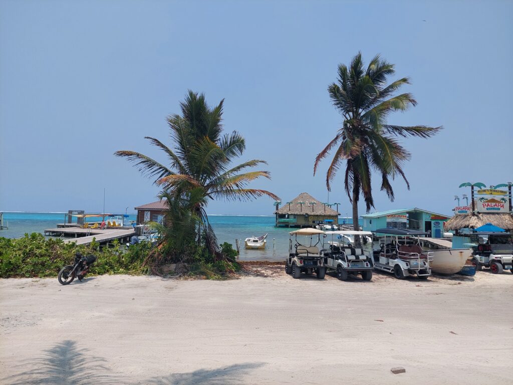
There were a few ways in which I could cross the border from Mexico to Belize, and I chose to do it with a boat ride. I got to the surprisingly small terminal when it was still closed, and waited for a while in order to check in and go through security. As time passed, a few more people came in, but overall it was pretty empty. When we did get on the boat, we were about ten, not including the staff. It was quite a bumpy ride, and it took about two hours to get to Ambergris Caye and the city of San Pedro. After getting through customs (which took only a few minutes), I was officially in Belize, ready to explore another country.
I had no idea how to get to the hostel, and had no internet to figure it out, so I walked around until I found a supermarket which had an ATM, got some cash, and then asked the employees for directions. I was given the employees’ wifi password, so I could simply use Google Maps. I thanked the guys for their help, and walked over to the hostel. It was early for check-in when I got there, so I dropped off my bags, and headed over to a nearby phone store to buy a SIM card. I had to pay for the card and the internet plan separately, which was a bit odd to me, but otherwise the transaction was straightforward.
Finally, I was ready to go exploring. Not far from my location there was a place marked on Google as Iguana Eco Sanctuary. It was mentioned a few times on the internet, in the minimal research I’ve done, and with nothing better to do I made my way over there, which was a bit confusing. The GPS on Google Maps acted up a little bit, which might have been due to the construction site that was on the way to the sanctuary.
After asking a couple of people for directions, I walked for a few minutes until I got to the entrance. A nice man welcomed me, and after I registered myself in the logbook, I was free to walk around. The place was surprisingly small, and didn’t take more than a few minutes to have a detailed look around. The iguanas were big, and it was nice to look at them, but that was it. There was a little path to go around, which I did pretty quickly, and after taking some pictures I left the sanctuary, going back to the hostel to check in and meet some of my roommates.
In the aforementioned minimal research I’ve done online while still in Mexico, I’ve seen some tours available in the area of San Pedro, but they were also ludicrously expensive. I thought it seemed weird, and hoped that once I got to Belize I could get better deals. Unfortunately, that was not the case, and it was just as expensive in the mainland of Belize, if not more. For the most part, I spent my time in the hostel, relaxing, chatting with other travelers, and hanging by the pool. It was a nice, relaxing place,
When I got a bit bored of that, I rented a bicycle from a nearby inn, and made my way over to Secret Beach, one of the most popular parts of the island. I rode for a while through the city, thinking that eventually the scenery would become more rural, but that wasn’t exactly the case. While there was less of a “proper” city view, I was cycling through what was the longest construction zone I’ve ever seen. For most of the way, one incomplete building after the other, it was somewhat of an eerie and sad sight. Eventually I made a turn and was going through a row of cabins for rent among some mangroves in a very quiet area. A little while after that, I got to Secret Beach, where I was glad to find out all the sun beds were free to use.
I went for a little swim in the water, dried off quickly, and got back on the bicycle. My original plan was to try and make it to the Marina Reserve Museum, all the way up north, but soon after leaving Secret Beach I realized this was not going to happen. Instead, I tried to make it to a closer point on the map, which was supposed to be another museum of some kind. I was unable to find the spot, and decided to go back to Secret Beach for a couple of hours before going back to San Pedro.
It was then time to leave the island and go to the mainland of Belize. There was some contradicting information online on how to actually travel around, so I just took it one step at a time and hoped I wouldn’t need to wait for too long at any point. The first part of the journey was the easiest part, taking the ferry from San Pedro to Belize city, which took about another and a half with a stop at Caye Caulker. From there I took a taxi to the bus terminal, where I needed to wait for two hours for the bus to Hopkins Junction. As was suggested online, I hopped in from the back, and had a place to put my luggage. After a few hours of driving around I was dropped off at the junction, along with a few other people. A taxi driver was waiting there, and while we got in he got a phone call. Apparently he had an important package coming, so he was going to wait there for about twenty minutes or so. Instead of waiting around, I got in another taxi and cleared the final stretch to Hopkins.
I settled in, was disappointed by the beach, and got ready to explore. Transport to any of the attractions nearby, once more, was disproportionately expensive, and actual tours would’ve cost even more. I was left with two choices-a combination of public transport and hitchhiking, or riding a bicycle. I opted for the second option. In the morning I went to the shop, rented a bicycle, and after getting my bag I headed out of town, toward Cockscomb Basin Wildlife Sanctuary, which was also known as the Jaguar Reserve.
For the most part,it was a smooth and uneventful ride. I got to the junction, turned left, and kept going straight until I came across a sign that informed me I got to Maya Center village. A few more minutes of riding, and I saw a sign telling me to turn right and informing me I have six miles left. I got there faster than I thought I would, and was under the impression I made a really good time.
Within moments, I realized my mistake. The right turn was onto a dirt road, which was bumpy, full of gravel, and with elevation changes. It was a slow progress, with some downhill sections quite dangerous, and I had no choice but to walk the bicycle in some parts. Those last six miles took another hour, and then I still had fifteen minutes of riding from the entrance of the park to the visitor center, where I registered, paid for the ticket, and got an explanation of the different trails around the park.
The longer and more challenging hikes, unfortunately, were longer than I expected, and required a tour guide, which unsurprisingly was expensive. That left me with the easier trails, and as I wanted to have a view of the area, it was recommended to me to do Ben’s Bluff trial. To make it more interesting, longer, and justify the bicycle ride over to the park, I decided to combine it with a couple more short trails.
The starting point for those trails was at the same spot, and I walked along the path for a few minutes until I got to a split in the road. The faster way to get to Ben’s Bluff was to the left, so I took the right path, starting the first section of the trail. I walked in the shade of the trees on the dirt path, looking around and wondering what kind of wildlife I might come across. The answer to that turned out to be nothing. For the most part, I failed to see any wildlife in the wildlife sanctuary. There were insects, which I heard more than I saw, and a couple of small lizards, but that was it. The road itself was nice, although not too interesting. It was nice to be in the shade and taking a break from the hot sun, but I was hoping for more. Pretty quickly I got to another split in the road, where I could turn left or go straight. I chose the latter, and a few minutes later I got to the end of the road. There was a bench with a table where I could see and rest, overlooking a shallow stream.
I sat there for a couple of minutes, then went back to the split in the road, and turned left. It was a quick and easy walk which ended in another resting area, overlooking a different part of the stream, and marking the exit of the tubing activity (due to the shallow water, I was told it’s not worth doing this activity). After another quick rest, I made my way along the last section of the short trails, which led me to the starting point of Ben’s Bluff.
Up to that point, the trails were all pretty leveled, posing no challenge. But then I started going up. It wasn’t a steep path, but it did require more effort. Most of it was among the trees, but every now and then there were clear patches, where I was under the hot sun. Even in the shade, climbing up toward the viewport, I was covered in sweat. It felt good, right, to be in nature, to be doing something I haven’t done in a while.
Eventually, the road started to level, and I found myself at another split in the road. I could keep climbing up toward the viewpoint, or go left to the waterfall. After a few moments of consideration I went along the trail to the waterfall. It took a few minutes to go down the path, and when I got there I saw a couple of people enjoying the water. I sat down to rest, and all of a sudden I felt tired, as if in one moment I was drained of energy. It was a nice place to rest and regain my strength, and a couple more people got to the small waterfall during that time. We all chatted for a little bit, and one by one everyone left, and I was by myself again.
When I felt ready, I got back up on my feet, grabbed my bag, and went back to the split in the road,from which I continued up the trail. This feeling I got, the sudden lack of energy, didn’t let go. The hot weather wasn’t new to me, the altitude was barely worth mentioning, and I’ve hiked along more difficult paths before. Something felt wrong, but I could not tell what. I was constantly running out of breath, and every few minutes I stopped for a quick rest.
After what seemed like quite a long time for me, I got to the end of Ben’s Bluff. Or at least, so I assumed, as there was no sign indicating it. It was a leveled area, with a nice viewpoint and another picnic table where I had my long lunch break. There was a sign there mentioning other trails for some reason, but no sign that told me exactly where I am.
Going down the path was a lot easier. I didn’t feel the need to stop at any point along the way, and it was easier to breathe, although something still felt off. I saw a few more travelers on my way down, but other than that nothing interesting happened. It took me nearly two and a half hours to get up to the viewpoint, and a bit over half an hour to get back down. And when I was down, I took slow and deep breaths, which wasn’t as easy as I thought it would be. I sat down for one final rest near the visitor center, and then got back on the bicycle for the long and difficult ride all the way back to Hopkins. It was not a good way to get to the park, but it was certainly cheap.