Zig Zag Trail, Hoo-Koo-E-Koo Trail, Old Railroad Grade, Double Bow Knot, Fern Creek Trail, Mount Tamalpais East Peak, West Point Inn, Rock Spring Trail, Cushing Memorial Amphitheater, Easy Grade Trail, Matt Davis Trail, Table Rock, Stinson Beach
So far I haven’t gone on any real hikes in California, and as my short stop was coming to an end, I wanted to see if I can find anything interesting in the area. At first, I thought about doing the Dipsea Trail, but after a bit of research it seemed the only challenge would be from doing the trail both ways, which I preferred not to do. While I have done trails that forced me to go back the exact way I came from, it’s generally when there is no other option, which wasn’t the case for the Dipsea Trail. I could find one trail that I was happy with, and so I opened Google and combined several different trails into one long trail, with some points of interest along the way to try and make it more interesting.
The bus dropped me off at Mill Valley Depot. Despite the forecast I looked at, it was quite cold and a bit windy. For the first section of the hike, I walked from the bus stop around the town until I got to the Dipsea Trailhead. Overall, it wasn’t very interesting, although there was no way to get around walking inside the town.
While it was the start of a trail, it was not the trail I was looking for, so I kept going along the road, got to the Cascade Falls Trailhead, and all the way to the end of the road. I kept going a little bit more, realized I missed a turn, went back a little bit, and finally was at the start of the first proper trail of the day, the Zig Zag Trail.
True to its name the trail had several turns to it, and at no point did it feel like I’m going straight, which I enjoyed quite a bit. While the weather wasn’t great, it wasn’t terrible either, and the rain from the previous days meant the flow of water around was pretty good. The real challenge on this trail was the incline. It was going up at an angle, quite steep at times, and I felt going down this trail, especially when it’s slippery, would be a lot more difficult than going up.
It took quite a while to go up the path, with some parts being a bit tricky. Despite the cold, I started to feel hot and build up a bit of sweat quite quickly. I wasn’t sure where I was on the trail or how long I still had to go, and there was no one else in sight. Then, I looked up to a gap between the trees and saw a building of some kind. The road started to level, and I kept going along the path until a few minutes later I cleared Zig Zag Trail.
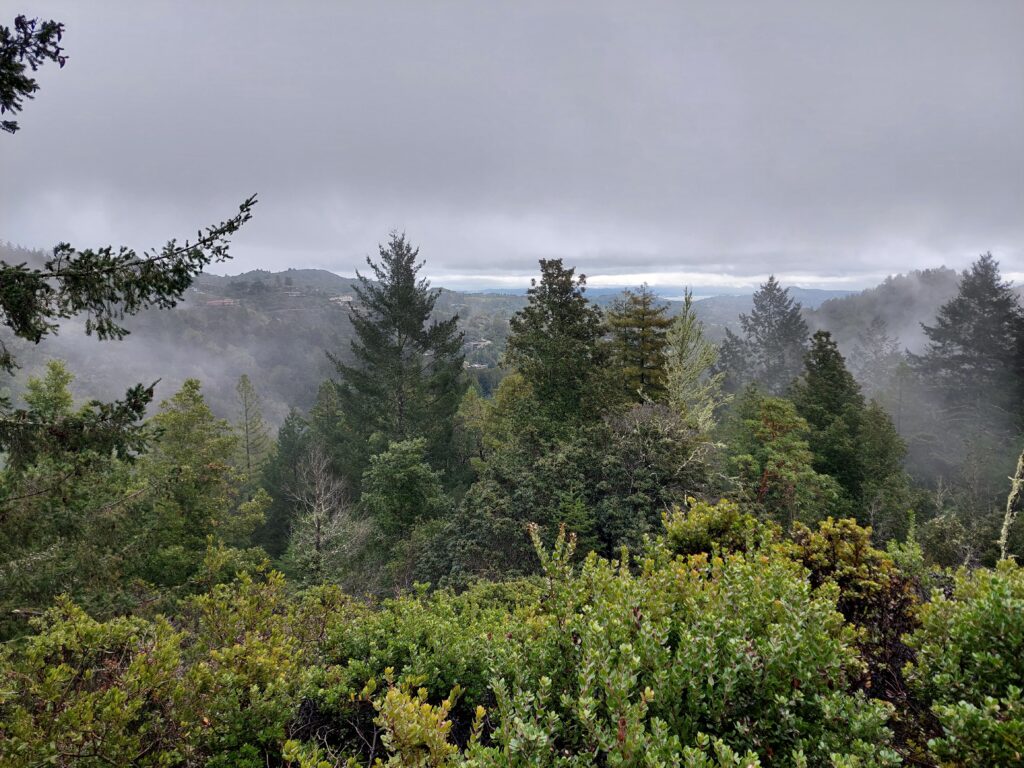
After looking around me and trying to figure out my next move, I started walking on the paved road for a while, turned around, and moved on to a dirt path that passed along the fire department station. I kept going until I passed it and eventually got to the beginning of Hoo-Koo-E-Koo Trail. As the day was quite foggy, there were no views to look at as I walked along the mountainous trail. I could see some treetops a short distance below me, but the visibility was quite poor. It was still nice to be out of the woods and on an open trail, even though there wasn’t much to look at and the weather seemed to be getting worse. For the most part the road was easy to follow, without any major changes, but occasionally I checked the maps on my smartphone to make sure I’m heading in the right direction.
At the next split in the road, I left Hoo-Koo-E-Koo Trail and turned into Old Railroad Grade. After a few minutes of walking around, according to Google I got to the first point of interest I marked on the map, Double Bow Knot. However, looking around me I did not see anything special. It might have been due to the weather, or maybe I was in the wrong place, but I had a long road ahead and didn’t feel like sticking around in order to try and find the right spot.
Instead, I turned around and went down along the trail, wondering how long it will be until I get to the end of it. At some point on that trail I saw another traveler going the other way, which was a bit surprising. I didn’t know if it was due to the weather, or if the trails I picked were simply not popular. Either way, seeing someone else there was the most interesting part of it.
From Old Railroad Grade I continued on to Fern Creek Trail, and the open road turned once more into a forest. It started drizzling a bit at that point, which was inconvenient but not too much of a problem. It was somewhat interesting to see the different trees and plants around the trail, the road kept twisting around for a while, but overall there wasn’t much in there. Just as I saw the next split in the road I also saw a couple other travelers coming from there, and a few moments later a runner came up from behind me, overtaking me on the way to the peak of the mountain.
The path to Mount Tamalpais East Peak started with a few wooden stairs, which were a bit muddy and slippery. As I climbed the stairs among the woods on the way up, I could hear the constant flow of water, but only partially see it as the trees blocked the view for the most part. It took a while to get up those stairs, and just when I wondered how long it would take, I saw above me the light from between the trees, and the road started to level one more until I found myself at the visitor center. It probably could have been a nice place to stop on a good day, but not when I was there.
From the visitor center there were a few different paths to choose from, and I chose the one that led to the peak. It wasn’t far away according to the sign, and the incline wasn’t as steep as Zig Zag Trail, but there were the ever so awful stairs. At a few points there was a hairpin turn and I changed direction, while I had a constant view of the fog below me which left me wondering what it could have been like if the sun was out. I eventually made it to the peak, which had a locked building. Just like the way over there, the east peak of Mount Tamalpais didn’t offer any good views, and along with the increasingly bad weather, made me feel like I should get down quickly.
At that point I felt like it might not have been a good idea to go hiking, but I was already there. I could go back the way I came, but I wasn’t too excited about it, and getting to the end of the path I planned seemed like it could be shorter anyway.
I went back down to the visitor center, crossed the empty parking lot and walked on a paved road for a while. The drizzling rain didn’t get stronger, but it was constant and unpleasant as I made my way down the road until I got to another turn in the road, which connected me back more to the Old Railroad Grade. The dirt road was of bumps and had a few muddy sections. Although I wasn’t tired, I started to feel hungry and wished for a warm and dry place where I could sit for a little bit.
After going around a few corners, I finally made it to the next point of interest, the West Point Inn. There were a few buildings there, which overlooked the foggy views of the mountain, with a few parked cars next to them. I could only assume the people who booked the place thought the weather would be better, or they really needed a getaway. As there were no public areas there, I had no place to sit down.
I decided to eat my lunch on the go, as I made my way along Fern Creek Trail. There were a couple of ways to go from the inn, and I picked the one I thought would be shorter. By the time I got there, the rain, wind, and fog all made me want to finish to get to Stinson Beach and the bus back to San Francisco as soon as possible. And as the trail was going back into the woods, I realized I much prefer to be out in the open, even (or maybe especially) on a day like that. Every now and then I would check my smartphone and take a look at the maps, checking if I’m on the right path and how much I have before the next turn to yet another trail.
Eventually I did turn around, and found a sign directing me to the amphitheater, which I didn’t think I’d get to, as it would have made the road longer. Perhaps I took the wrong path at some point, but I felt like I didn’t have much of a choice, so I simply followed that road among the woods until quite a while later I found myself at an open area with a lot of sitting space. I made it to Cushing Memorial Amphitheater, and did so just as the rain finally stopped.
I found a partially dry rock that I could sit on for a couple of minutes. While I didn’t feel very tired from the walk, there was a mental difficulty as well, and on top of that I needed to check the maps once more, to pick the next trail from the amphitheater.
While originally I planned to go along Old Mine Road, I saw a sign to Easy Grade Trail, and I picked that one instead as I thought it would be easier and faster. I’m not sure if it was indeed faster, but it certainly wasn’t fast. I was back in the woods, and I just wanted to get it over with. While the rain stopped, there was still a drizzle from the treetops, and I still got wet and I walked around. The road was going down, mainly in a gradual slope, but at a few sections it was a bit steep. My shoes got covered in mud, and so did my pants, but at that stage I barely noticed it, the only thing on my mind was to get to the end.
Eventually I did go to the end of the trail and onto another paved road, on which I kept walking for a while until I heard a noise behind me. I turned around to find another hiker going around the woods, and stopped to ask her for directions. On top of helping find my way to the next and final trail, the hiker introduced herself as a park volunteer, and after chatting for a little bit while walking along the road, she handed me a physical map and we parted ways. Although the map was nice to have, I only looked at it briefly before I stored it in my damp backpack as I started to walk along Matt Davis Trail. I wasn’t good at reading physical maps, and beyond the initial look where I could see where I am and where I need to go, I could pinpoint myself along the trail, so that left me with the smartphone maps.
Matt Davis Trail started in the woods, although after a little while I was back in the open, and once more wondered what views would have been revealed by the sun. Then, somewhere along the way, something weird happened. As I checked my smartphone, it seemed that the road was just getting longer and longer, to the point I wasn’t sure I’d be making it to Stinson Beach in time to catch the bus. I might have slowed down without realizing it, or maybe the maps didn’t quite work, or it could be another reason. Either way, I started to get worried.
As I got back into the woods, I very deliberately started to walk faster, as much as I could without tripping over branches, slipper leaves, rubble, and muddy stairs. Somewhere in the back of my mind there was a part that wanted to appreciate the road, but I simply didn’t have time for that. I needed to get down, and fast, otherwise getting back to the hostel would have been a lot more expensive. And so, without looking around me too much, I crossed the path in the woods, got to the point where it opened up again and I could start seeing some urban views, and then kept going all the way down. I made it to the bus station with about fifteen minutes to spare.
It wasn’t good weather, and if I had any idea there was a good chance I wouldn’t have gone on that hike. But despite the challenges the day presented, I still enjoyed being in nature, even if at the end it was a bit too much.
And with that, it was time to leave California and the USA behind me, at least for the time being. It was, for lack of a better word, weird. Every accommodation that I stayed at seemed flawed in some way, I didn’t have as many experiences as I thought I would, and getting out of the big cities was quite complicated. The most interesting thing I did was going to the Medieval Torture Museum, which wasn’t an American experience. On the other hand, I didn’t get familiar with some of the fast food chains, and even went to a diner, once, when all the other options in the area didn’t seem satisfying. It also felt quite lonely, similar to Australia, and after the great social interactions I had in Fiji, that was quite a let down for me.
Did I go to California at the wrong time? Was I just tired? Or was there something else I didn’t consider? I didn’t have any answer to those questions, but I didn’t want it to have a negative effect on any future experiences.