
Simon Bolivar Park, Treasure Museum, Recoleta Viewpoint, Churuquella Viewpoint, Glorieta Castle, Cal Orck’o, The Seven Waterfalls Hike, Samaipata Fort, Samaipata Archeological Museum,
After I left La Paz, things didn’t go as I planned. I lost my trekking poles, most likely on the bus to Uyuni. Then, I was surprised by how difficult it was to find a tour of the salt flats with an English speaking guide. I settled for a 1 day tour, which was a disappointing waste of time, and if that wasn’t enough it seemed that I got ripped off, and anyone who booked the tour from La Paz got a much better deal than me. Immediately after the tour was over I got sick, and wasn’t able to go anywhere for a couple of days.
When I got better I headed to Tupiza, which looked far more interesting and beautiful, but I wasn’t able to find decent accommodation there, so after a quick tour of the nearby area, I left the south of Bolivia and made my way back up. I was disappointed I couldn’t explore there on my own terms, but I didn’t have many options.
My next stop was Sucre, the capital. I took some time to rest, and then headed out to see some city sights. First on my list was Simon Bolivar Park, which was a nice, green area, with a couple of fountains and a small tower. Going up this tower, the only view was of the trees and not much else, so after a quick look around I left the park.
Since I was interested to learn more about the city, and the country, I went to the Treasure House. I was informed I must join a tour, and thankfully there was one available in English. The tour included several rooms, with different metals and crystals. The guide explained a little bit about the history of the house itself, and then proceeded to talk about different mines, and the process to get metals, mainly gold. We ended up in a room with a few crystals, and that was it. It was a nice stop, but not that special for me. I also planned to go to the Freedom House, but I went by several times and it was always closed.
I then walked around the city for a little bit, and ended up next to the Recoleta monetary, which had a small square next to it, and a view of the city. It wasn’t an amazing view, but it didn’t take long to get there, and it was a nice stop along the way.
From there I kept going up, walking through the city stress for a little while longer, before turning into a trail which was mostly old, stone stairs, leading into the woods and the Churuquella viewpoint. It took around forty five minutes or so to get to the end of the trail, where there was a flat platform, and a big statue in the center of it. Unfortunately, being in the middle of the woods, there wasn’t much of a view to look at, and I quickly left the place. On the way back to the hostel I passed by Guerero Mansion, but that, too, was closed.
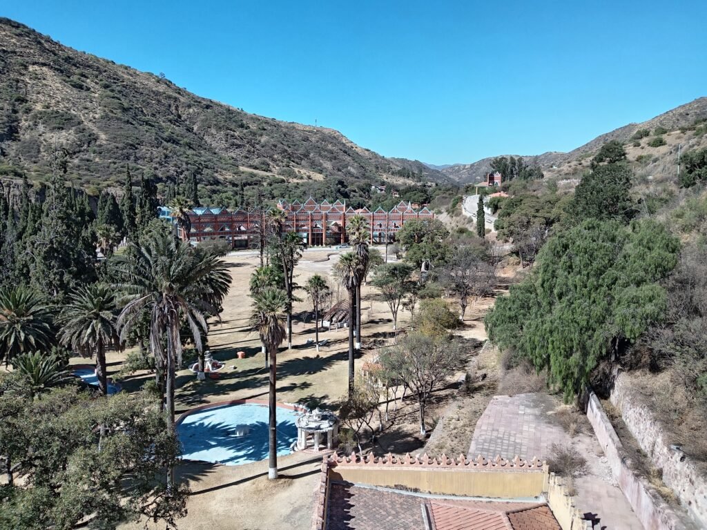
Going a bit outside the city, I took a bus to Glorieta Castle, which from what I understood belonged to the only prince and princess in Sucre. I got to the castle fairly easily, paid the entry fee, and was free to explore on my own. There were a few signs which gave a brief idea of various rooms, like the dining hall and the bedroom, but for the most part it was pretty empty. It looked more impressive on the outside. After going around the first floor, I got up to explore the second floor, and then to the prince’s tower, from the top of which there was a nice view of the area.
As I made my way down, I came across a man who pointed me to a guided tour. Since I had time, I thought I’d give it a go. Since the tour was in Spanish (I didn’t catch the English tour), I struggled to understand more than a few words. After going around pretty much everything that I’ve already seen, the tour also went to a wine cellar which I missed, and a library. Then the guide said goodbye and I took a quick look around the garden attached to the castle before getting on the bus back to Sucre.
The next thing that caught my eye around Sucre was Cal Orck’o. After a half hour ride in the “dino bus” I paid the entry fee for the archeological park, and was directed immediately into a room where a video was playing, talking about various dinosaurs.After about ten minutes or so, the guides arrived and split the group into Spanish speakers and English speakers, and joined the latter. We started by going around the entrance, where we passed by a couple of museums and quite a few dinosaur sculptures, and our guild told us a fair bit about them.
Heading into the area where the footprints were, we had to put on hard hats. Before getting to Cal Orck’o, I was under the impression I’d see a well preserved print of a T-rex, something I probably have seen in TV and movies. I was wrong. What I actually looked at was a near-vertical wall that had some dents in it. At first it was barely noticeable, but as the group walked along the path, I couldn’t ignore the fact that those (mainly) circular dent had a clear pattern. I wasn’t fully convinced by the whole thing, and it was quite far from what I imagined it would be. It wasn’t the first time I wondered if I should’ve done more research.
Before leaving Sucre, I want to see some of the nature around it. Initially I thought about going to the Maragua Crater, but I couldn’t find any public transport that goes all the way there, and I wasn’t up to a 2 day hike. Much closer to the city was the Seven Waterfalls hike, which sounded quite fun.
After a ride of about forty minutes, I was dropped off at the last stop, in a place called Alegria. From there I started walking around less developed and far less crowded areas, following the map on my smartphone. It was a nice walk, mostly on dirt roads, and after about twenty minutes or so I got to what seemed to be the end of the road. I wasn’t quite sure where to go, as the trail did a U-turn and took me back the way I came.
Unsure of how to proceed, I had to find someone to ask for direction. The guy I asked didn’t seem very sure, but I didn’t want to give up easily. Back at what seemed to be the end of the road, I started going down a rocky terrain, along a path that, if it had been marked at some point, it was probably a long time ago. Nevertheless, with the smartphone in my hand, and a mostly-dry river to my right, I went down the hill. The views were nice, and the further down I went the more excited I got. According to the smartphone, I was indeed on the right path, and soon enough I got to the bottom of the hill, and the first of several river crossings I had to deal with on this hike.
It wasn’t a difficult crossing, as the river at the point was shallow and dry, so I quickly went on my way. Not even five minutes passed by, and I had to cross again. Without a clear trail, I just stuck with the river, as it seemed to be leading to the waterfalls. The rocky path was quite enjoyable, and even though a proper path wouldn’t be easier and more comfortable, I preferred to make it without any clear signs.
It took just under an hour before I got to what on the map seemed to be the first waterfall, possibly with the second and third as well. It was a fairly small waterfall, flowing into even smaller streams, which I don’t think can count as waterfalls. Still, it was nice to see. But there were other waterfalls ahead, and I wanted to try and see all of them.
Since there was no trail, I had to climb a few big rocks in order to get closer to the first waterfall. I looked around for a path that wasn’t there, until my eyes lay on a rubber pipe that went on beyond the waterfall. Next to it was a somewhat clear path, with some improvised stairs, and several minutes later I was on the other side of the first waterfall. According to the map, two more were just around the corner.
The map was wrong. There were two ponds there, which I quite enjoyed, but only one waterfall. It was bigger than the first, prettier, and had slightly better flow, but that was it. I tried to find a way around it, to try and look for more waterfalls, but the climbing at that point felt too risky, especially when I was by myself, so I decided to give up and make my way back. At best, I saw four waterfalls, although I’d say I only saw two, really. I still enjoyed the way, and would recommend this hike for anyone who wants to get out of the city for a little bit, but perhaps with different expectations. Or more research.
My time in Sucre had come to an end, and before Santa Cruz, I made a short stop in Samaipata. I got there in the middle of the night, and after just relaxing for a while and waiting for the sun to come up. My first destination was the famous waterfalls. But when I got there, it turned out they were closed, without a clear date for reopening.
I had to wait a little for a minibus to come by, which dropped me off at the intersection for El Fuerte fort. From there I had an okay walk of about an hour and a half to get to the site itself. The views were nice, when the trees didn’t get in the way, but it wasn’t amazing and taking a ride would undoubtedly make things easier.
There were more, and better, views along the proper trail around the fort, along with several viewpoints, overlooking the area, the remains of the fort, and of course, the center piece– the carved rock. Signs were not always present, and their information was limited, so I didn’t learn all that much, but since I actually did some reading for once beforehand, I expected that. The main focus was on the views, which were quite good, although I’m not sure they are good enough.
Going around took me about an hour, and then, since the taxi driver wanted too much money, I walked most of the way back to the city before I found a more reasonably priced transport, which took me to the Samaipata Archeological Museum. It was fairly small, with a few different rooms that talked about different aspects of both the fort, and Samaipata. It was included in the ticket to the fort, which is the main reason I went there, but after a quick look around I called it a day and went to the hostel to get some rest for all the walking.