Banyowla Regional Park
Struggling to find any accommodations in the center of Perth, I found myself in Armadale where I was hosted by a kind family along with a couple other travelers. We had a nice dinner together and in addition to that we also managed to see a fireworks show, although it was quite far from the house and wasn’t very impressive at that distance. In the following morning there was another nice meal, and then I wanted to go out and have a look around this not-so-touristy area.
Not really knowing what to do or where to go, I followed the advice of my hosts and set out trying to get to a place called Ellis Brook Falls. Looking on Google, I couldn’t figure out if it was part of the Banyowla Regional Park or Korung National Park. I wasn’t entirely sure if there is a difference between the two, or if the same area has two different names.
I started the hike at a water tank near the beginning of what was marked on Google Maps as the “Contour Channel Walk”. As I was told, in the past an aqueduct was built in the area to provide water, although it hasn’t been used in many years. It was more modern and made of pipes, not one built in the ancient Roman style.
Being in a quiet area, the sound of traffic was barely there, although I wasn’t too far from the city at any point. I walked between the bushes and for a little while I wasn’t even sure if I am on a proper trail, and how much I can count on the navigation apps. The sound of birds, insects, and other animals was very noticeable in that area, only occasionally being disrupted by the sound of vehicles passing by.
Within a short while I found myself on a proper trail, and after consulting the navigation apps, I picked what I hoped would be the right direction and resumed my walking. Every now and then I saw the aqueduct and took that as a sign that I’m heading in the right direction. The path had twists and turns, so I didn’t always have the aqueduct in my sight, but it would reappear over the next bend in the road.
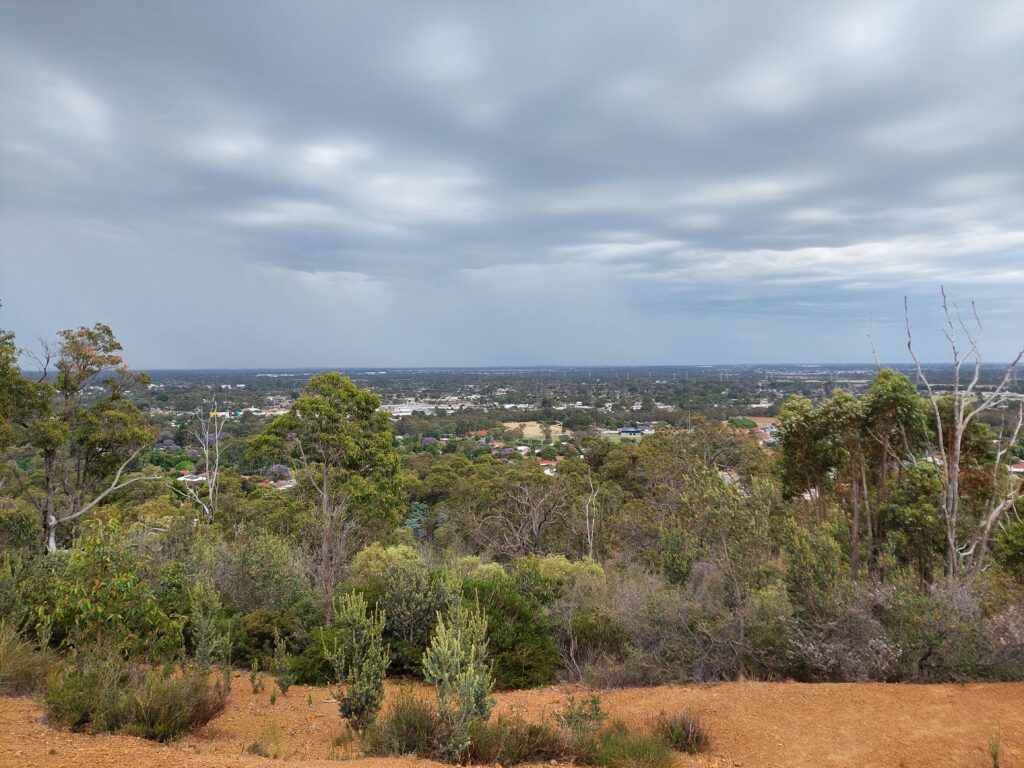
On one side there were plenty of trees and bushes, which were nice although not particularly interesting after looking at them for more than a couple of minutes. On the other side there were plenty of other trees, but as they weren’t growing densely next to each other, there were many gaps between them, and I had a lovely view of the city in the distance along with the green trees that were closer to my location. As I walked along the trail, the view kept changing, looking a little bit different every time and providing an added level of interest and variety to the whole thing.
After a little less than an hour I reached the end of the aqueduct, which was an important milestone. As the maps didn’t paint a clear picture, I didn’t know if I could go from that point to the falls, or if I’d have to go back. Although the aqueduct ended at that point, the trail didn’t, and so I kept following it, at this point starting to go downhill. At parts, the road was quite steep and I slid down sideways, making my way slowly and cautiously, not quite sure where I would end up.
I went further and further downhill, until I could hear some cars. A few minutes later I could also see them and the road they were driving on. Consulting my smartphone again, it looked like the road to the falls was the asphalt road, so I started walking along, careful to not get in the way of traffic. The city sights were gone, and the boring part of the walk began.
It was a pretty easy walk, but there was nothing special on it. I still checked the apps every now and then to make sure I’m heading in the right direction. Despite what the apps said, I eventually came across a no entry sign. There was an alternative route suggested by Google Maps, but it was considerably longer and pretty boring. At this point I decided to give up on trying to hike up to the falls and started making my way back.
The way back wasn’t as simple as I thought it would be. I’m not sure exactly when it happened, but at some point I made a wrong turn somewhere, which resulted in me getting back to the dirt track from a different part of the park. It wasn’t bad, but i was confused for a little bit.
On the bright side, I got a different scenery to look at, although not by much. Soon enough I got to see more city views, and as it was a bright and sunny day I could see quite far into the horizon.
Then I just kept going uphill, feeling quite thankful for the lack of stairs. At some point, still on a bit of a different trail I could see the aqueduct again, and down the road I somehow found myself walking on top of it. On and on I went, starting to go downhill, until eventually I hit some familiar spots from earlier in the day, and not too long after that I was back at the house where I started my hike.
Even though I didn’t end up where I wanted, I still enjoyed the hike, the weather, and the hospitality of the family I was staying with. It was a short and sweet visit, which made me feel like I was lucky to struggle finding accommodations in the center of Perth.
This topic is simply incomparable :), I’m very interested.
Yes indeed. It was with me too. We can communicate on this theme.